Iowa Meteorologists Among Those Helping to Forecast Hurricane Ian
Hurricane Ian continues to move toward Florida's west coast. As the storm gets closer to landfall, weather offices across the nation are helping forecasters more accurately predict what the storm will do. One of those weather offices is here in eastern Iowa.
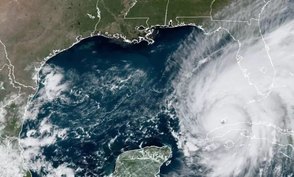
Early today, Ian made landfall in western Cuba. It was packing 125 mph winds, making it a Category 3 hurricane. It's expected to strengthen into a Category 4 storm in the Gulf of Mexico before hopefully diminishing in intensity before making landfall at around 7 a.m. eastern time Wednesday morning. At 1 p.m. eastern, the National Hurricane Center says the storm has maximum sustained winds of 115 mph and is moving north at 10 miles per hour.
How strong will Hurricane Ian be, exactly where will it make landfall, and what will be its impacts? All are important questions that forecasters continue to work on.
National Weather Service offices around the U.S. are sending up additional weather balloons to assist with the hurricane forecast. Among those is the National Weather Service in the Quad Cities. They've doubled the number of hydrogen weather balloons they're launching each day.
According to KWQC, each weather balloon has a weather instrument that gathers data on everything from temperatures to pressure, wind, and humidity. They can capture the data up to 100,000 feet. It's then made part of the information entered into computer models.
Rich Kinney, the Warning Coordination Meteorologist at the National Weather Service Office in the Quad Cities told KWQC,
"Having this additional data really helps the forecasters at the National Hurricane Center when they’re tracking the models through time. For example, based on today’s launch we’ll have a certain set of computer models. And then later this evening, another balloon launch and another run of the computer models. So they can track the different runs of these models to see if they’re maintaining consistency."
LOOK: The most expensive weather and climate disasters in recent decades
Gallery Credit: KATELYN LEBOFF
KEEP READING: Get answers to 51 of the most frequently asked weather questions...
More From 104-5 KDAT
![5 Times Iowans Were Featured on ‘Unsolved Mysteries’ [WATCH]](http://townsquare.media/site/675/files/2022/11/attachment-twins.jpg?w=980&q=75)